
The Indian Space Research Organization (ISRO) on Thursday accomplished the task of developing the country’s own navigation system with the successful launch of IRNSS-1G, the last in the series of seven navigation satellites. Here are 10 things to know about desi ‘GPS’:
12-year mission life
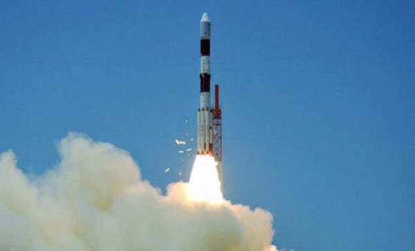
Polar Satellite Launch Vehicle (PSLV) C33 carrying IRNSS-1G (Indian Regional Navigation Satellite System) lifted off from the first launch pad at the Satish Dhawan Space Centre in Sriharikota at 12.50pm on Thursday. Around 20 minutes after liftoff, PSLV-C33 successfully placed IRNSS-1G in orbit. The satellite has a 12-year mission life. The first satellite IRNSS-1A was launched in July 2013, the second IRNSS-1B in April 2014, the third on October 2014, the fourth in March 2015, and the fifth, sixth and seventh on January 20, March 10, and April 28 2016.
With the constellation of satellites complete, India has joined the league of countries that has indigenous navigation system. The system will reduce the country’s dependency on US Global Positioning System.
The system, which will be fully operational in a month’s time, offers applications for marine and air navigation and can be integrated into mobile phones for use by hikers or fishermen, for example.
PM Modi names new navigation system as ‘NAVIC’
Hailing the successful launch of navigation satellite IRNSS-1G, Prime Minister Narendra Modi has named the new system as ‘NAVIC’ (boatman) as he dedicated it to the people of the country and said SAARC countries can also take advantage of its services.
Modi gave the expanded form of ‘NAVIC’ as ‘Navigation with Indian Constellation’. He showered praise on ISRO scientists for giving the “priceless gift” to countrymen, saying they have realised the dream of ‘Make-in-India’, ‘Made-in-India’ and ‘Made-for- Indians’ to fulfill the needs of common people.
Apart from India, only a few other countries, including the US, the European Union, China and Russia have their own navigation systems in place.
Indian space agency officials said IRNSS system is unique as it consist only seven satellites while other systems in the world have more than 20 satellites. However, while most other systems are global, the Indian system is regional in nature.
No more denial of info during war
An Indian-owned satellite navigation system is crucial to get positional accuracy during war or a war-like situation as the country may be denied such information by countries owing similar systems during such times. For example, the US denied GPS information during the Kargil war in 1999.
The IRNSS system is designed to provide accurate position information to users within the country and in the region extending up to 1500km from the boundary.
The desi ‘GPS’ will aid terrestrial, aerial and marine navigation, vehicle tracking and fleet management, disaster management, mapping and geodetic data capture, visual and voice navigation for drivers. The service can also be integrated with mobile phones and can be navigation tool for hikers and travellers.
According to ISRO officials, the total cost of all the seven satellites was Rs 1,420 crore.


Leave a reply